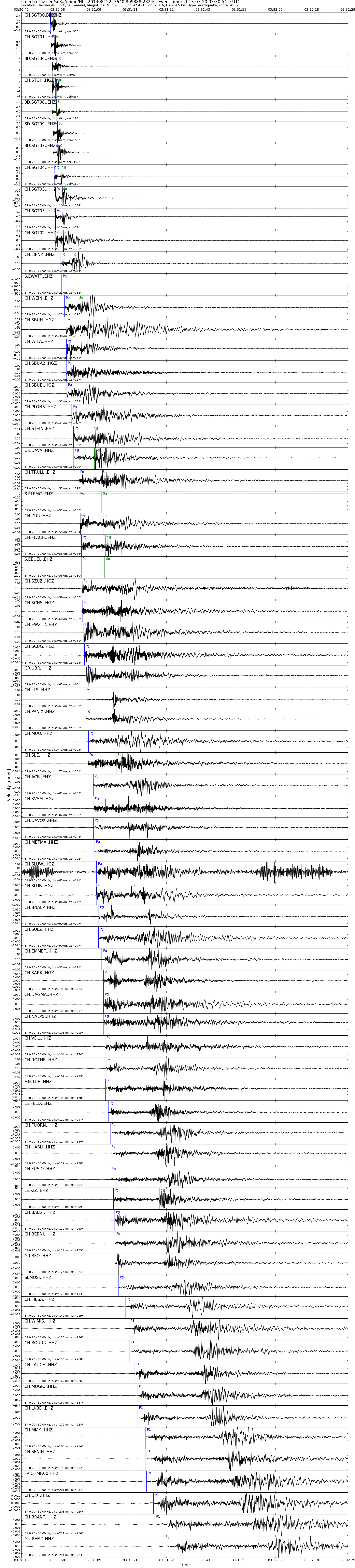
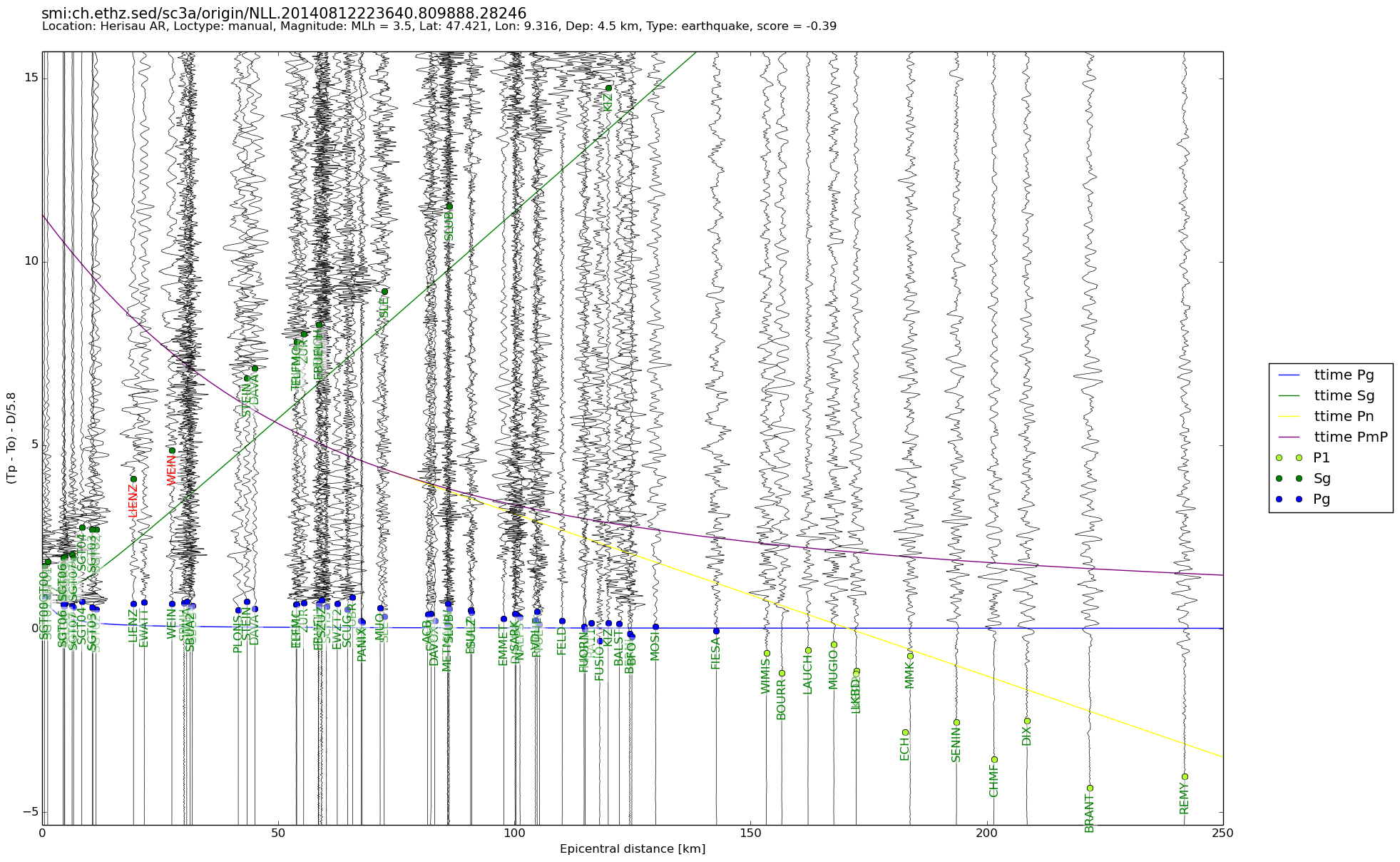
| Local time | 2013-07-20 05:30:54 |
|---|---|
| UTC Time | 2013-07-20 03:30:54 |
| Event Type | induced earthquake |
| Latitude / Longitude | 47.42 / 9.32 |
| Swiss Coordinates | 741625 / 253925 |
| Magnitude | 3.5 |
| Magnitude Type | MLh |
| Location | Herisau AR |
| Depth [km] | 4.5 |
| Location Type | manual |
| Agency | SED |
| Last Update | 12-08-2014 22:36:48 |
| Danger level | - |
| Origin ID & Metadata | smi:ch.ethz.sed/sc3a/origin/NLL.20140812223640.809888.28246 |